This version of the story is updated to reflect that the meeting is this evening, Nov. 16.
A King County official will hold a public meeting tonight to present updated landslide hazard maps.
Islander Greg Wessel, an environmental scientist and engineering geologist with the Department of Permitting and Environmental Review (DPER), completed a considerable portion of the work and will lead the meeting on Vashon. The island meeting is one in a series held in communities around the county and intended to help people interpret the new maps, learn about landslide geology and reduce their risks.
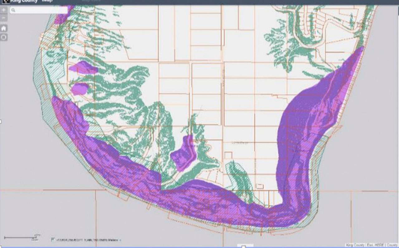
This new mapping, available though King County iMap, shows potential landslides and steep slopes, and may be particularly helpful to islanders. Vashon, Wessel said, hosts about one-half of the landslide risk in unincorporated King County.
Wessel noted the information will be helpful at the county, as officials apply building code to projects. Currently, for people who wish to build near a steep slope or landslide hazard, there are restrictions, including that landowners must demonstrate there is no hazard or that they will mitigate a potential hazard for themselves and their neighbors.
Beyond that application, Wessel said he expects it will bring broader benefits, including for King County Roads officials, emergency planners and current homeowners.
He suggested that if homeowners look at the map of their property and see the purple shading indicating potential landslide hazards and the dark green of a steep slope and want more information, they should call him. He had some general advice as well.
“If you are near a steep slope, it is a good idea to know where your water is being routed to make sure you are not creating a problem for yourself,” he said.
While King County uses landslide hazard mapping in several ways to help identify and address risks that could effect public health and safety, it did not have up-to-date tools until recently to do so. Wessel noted the project has its roots in the deadly Oso slide of 2014. At the time, Executive Dow Constantine asked if King County had a similar potential hazard, but the answer, Wessel said, was unknown. The county’s maps, from 1990, were outdated, so funds were provided to update them; the result is being rolled out now.
Wessel cautioned against people looking at the maps and growing alarmed.
“I think it is easy to look at this and assume the worst,” he said. “That is not what we mean.”
He stressed that the purple shading does not indicate known hazards, but rather, potential hazards, including rockfalls, slumps and other deep-seated landslides, and slopes undercut along a shoreline, among other features.
The creation of the current maps was a desktop exercise, Wessel added, accomplished through the combined use of LiDar imagery and more recent geological mapping prepared by state and federal agencies. LiDar, he noted, stands for light detection and ranging. The technology utilizes an airborne altimeter that takes billions of measurements and creates a topopraphic map with a high degree of accuracy.
Overall, he said, the mapping he created is a reasonable approximation of the area’s landslide areas, but it is not definitive.
At the meeting, in addition to the information Wessel provides, there will be a short presentation by a geologist from the state’s Department of Natural Resources to discuss their landslide mapping efforts statewide.
For more information about potential landslide hazards or related land development questions, islanders should attend the meeting or contact DPER.
The meeting is scheduled for 7 to 8:30 p.m. Wednesday, Nov. 16, at the Vashon Park District building at Ober Park. Contact DPER at 296-6600.