In the early hours of a rainy and cold January morning, a neighbor makes the first 9-11 call reporting that a landslide has inundated Luana Beach Road on Maury Island.
That was the beginning of a tabletop exercise conducted last week by VashonBePrepared for the island Medical Reserve Corps. The goal was to promote a better understanding of how those at the scene of a disaster on the island may coordinate and work together during a real emergency.
The exercise comes as the United States Geological Survey (USGS) has released a new tool aggregating existing data available nationwide into a searchable, interactive digital map. The new tool catalogs landslide occurrences across the U.S. in a central index for the first time, though for now, the resource is only intended as a starting point for mapping areas that could be at higher risk for future slides.
Rick Wallace, the vice president of VashonBePrepared, said that in emergency management, there is a tension between whether to devote more preparation time for the worst-case scenario — a 9.0 earthquake, for example — versus preparing for events that happen more often, such as severe weather. On Vashon, he said, no matter the emergency, many of the challenges will remain the same.
“I think it’s important to recognize that we are preparing to the extent we can. We’re a small place with limited resources and there [will be] a big time delay before our off-island help would arrive,” he said.
He cited King County’s Regional Hazard Mitigation Plan, now undergoing the final stages of a five-year update process, that ranks landslides as a serious risk, though not as much as other, more widespread, hazard types such as severe weather or earthquakes. But when large slides occur, such as the devastating Oso slide in 2014 that killed 43 people, their severity can rival many of the deadliest natural disasters in American history.
“It’s always been in our thinking. We have always worried about landslides,” he said.
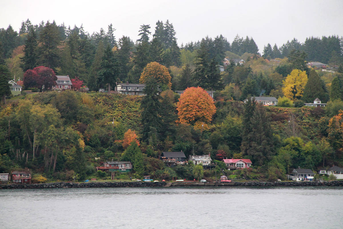
Wallace noted that most of the island’s shoreline is susceptible to slides — Luana Beach is not more likely to experience a landslide than any other shoreline on the island. It just made for a good test of the island’s readiness for such an event, since the characteristics of the area would make it particularly challenging for first responders as the situation developed.
In the scenario, emergency personnel discovered two dozen houses uprooted by the 800-meter wide surge of mud that carried homes down the slope, blocking the narrow road and endangering the integrity of remaining structures in the vicinity. The National Weather Service predicted rain to continue for at least three more days, hampering conditions and search efforts for the undetermined amount of people who were in their homes at the time of the slide.
Wallace designed the Luana Beach scenario and based it on what he observed at Oso firsthand, working as a volunteer in the Snohomish County Emergency Coordination Center to assist recovery efforts. It paints a bleak picture — cries for help can be heard within the landslide area. Utilities are shut off. The stench of broken septic systems fills the air. Media outlets demand site access and interviews with authorities, including the overwhelmed Vashon Island Fire & Rescue (VIFR), and misinformation is abundant.
Nine members of the island’s Medical Reserve Corps, joined by Fire Chief Charlie Krimmert and Assistant Chief Bob Larson, took part in the exercise. What it assessed was how both organizations can best collaborate in a natural disaster, thinking through the logistics of such a situation and the command structure in place.
Doing so, said Wallace, will enhance leadership on the ground, making assistance from volunteers and emergency responders alike more effective.
“If you think of it like a [performance], we are putting on a play on a stage that will allow the participants … To suspend disbelief, just like in the theater, and embrace the idea that they may have to deal with some of this,” he said.
In the wake of the Oso tragedy, the county updated its own landslide hazard maps to better educate the public about landslide risks and regional geology. Islander and geologist Greg Wessel was deeply involved with creating those maps using a combination of topographic LiDar, or light detection and ranging, imaging technology and up-to-date geological mapping prepared by state and federal agencies. The maps display a host of features and potential hazards unique to the county, including shallow debris slides, rockfalls, slumps and other deep-seated landslides.
Wessel said the information is useful for permitting and building code purposes, as there are restrictions on construction near steep slopes — landowners are required to demonstrate their property will not be in jeopardy or create potential hazards for themselves and their neighbors.
“There are several spots around the island that have moved historically and have had damage,” said Wessel, noting that some shoreline cabins have been destroyed in the past “because that’s where the steepest slopes are, on the edge, and that’s where the shoreline erosion occurs; that’s where you’re going to get these potential failures.”
But he emphasized that the potential slide risks identified by the maps should not cause alarm.
“If you live in an environment like that or one we have highlighted or the state highlighted then you should think about it but you shouldn’t lose sleep over it,” he said, adding that if homeowners are concerned about their own risk, they should call the county’s Department of Permitting and Environmental Review for an evaluation.
Greg Rabourn, who is responsible for safeguarding habitat on Vashon and Maury Islands as the watershed steward for King County, recommends that homeowners with property high on a bluff manage water saturation by planting a variety of native vegetation to slow erosion and cut back invasive species, such as ivy, which kills native plant life and can destabilize slopes.
For shorelines, he said, gentle erosion can be part of a healthy functioning ecosystem — so long as there aren’t people nearby put in harm’s way — replenishing beaches for the myriad of life that depends on intertidal habitat.
“The beaches on Vashon are sustained by landslides which can be very gradual or very significant all at once,” he said, noting the county’s plan to remove a 210-foot long portion of the bulkhead near Dockton Marina next summer. Once it is gone, he said, “we would expect initially there to be some significant sliding but then over time it would slow down and new plants would establish and [restore] natural function of the shoreline again.”
Making predictions about where slides will occur and what they will look like was the impetus behind the creation of the Geological Survey’s new map tool, which shows the level of confidence in landslides nationwide, including on Vashon. USGS geologist Ben Mirus said the goal for the map is to shed light on where the public, land managers, emergency planners and researchers can look for landslides before they happen, as well as where they have happened.
The availability of that data across the country, he added, is inconsistent at best, acknowledging the extensive mapping already completed by the Washington Department of Natural Resources that helped inform the USGS’s project, so far as having up-to-date data for the state.
“Our [map] is useful for showing what has been well-mapped and what needs work,” he said, adding that periodic updates of the database are planned as new or improved data become available. “This is the first step to getting the data available in a central place on a national scale. We know it’s incomplete, but what we don’t know is where it’s incomplete.”
More information about the USGS’s Seattle-based rain gauge and landslide hazard monitoring is available online.